Drone surveying stopped being a novelty for small crews a while ago. In 2026 it is the default way teams capture topographic data on sites under a few hundred hectares. The hardware is what changed. RTK and PPK positioning now ship on aircraft that weigh under a kilo, mechanical shutters are standard on mapping cameras, and a single flight can produce a centimeter-level orthomosaic without a single ground control point. None of that removes the paperwork. The FAA’s drone registration and Remote ID rules still apply to any drone over 250 grams, and commercial mapping almost always falls under Part 107.
We compared five mapping drones on the things that change a deliverable: ground sample distance, sensor size, shutter type, real flight time, payload flexibility, and how much cleanup the data needs afterward. Manufacturer flight times assume ideal conditions, so read 49 minutes as roughly 35 to 40 minutes of useful mapping once wind, temperature, and the climb to altitude take their cut. Camera specs usually matter more than endurance anyway. A 20MP 4/3 CMOS sensor with a mechanical shutter beats a 48MP rolling shutter on almost every photogrammetry job. We also weighed what each aircraft costs to keep flying, batteries and repairs included.
Rules vary more than most buyers expect. In the United States, Part 107 certification is required before you charge for a mapping flight, and our guide to drone laws in the USA covers flight over people and operations beyond visual line of sight. North of the border, Canadian drone rules split work into basic and advanced operations, and anything near controlled airspace needs a flight review. Starting from zero? Walk through how to get a drone license before you walk through a checkout page. Budget a few weeks of study plus the exam fee.
Accuracy claims deserve skepticism. A drone advertised at 1 cm GSD will not deliver 1 cm absolute accuracy without correction or ground control. All five picks below support RTK or PPK, and several accept third-party payloads. What separates them is endurance, weight, and how comfortably they handle 200 hectares in one morning. Buy batteries before you buy megapixels. Endurance finishes a survey, and a camera that never leaves the ground produces nothing. One more thing worth knowing up front: the cheapest aircraft here is still a serious purchase, and the heaviest one needs a two person crew to fly it properly.
How Do the Top Options Compare?
| Drone | Best For | Flight Time | Camera | Weight | Price |
|---|---|---|---|---|---|
| DJI Matrice 4E | Best overall mapping drone | 49 min | 4/3 CMOS 20MP, mechanical shutter | 1,215 g | Check price |
| DJI Mavic 3 Enterprise | Best value entry into RTK mapping | 45 min | 4/3 CMOS 20MP, mechanical shutter | 920 g | Check price |
| WingtraOne GEN II | Best for large-area corridor surveys | 59 min | 61MP full frame | 3.7 kg | Check price |
| DJI Matrice 350 RTK + Zenmuse L2 | Best LiDAR through canopy | 55 min | 20MP RGB plus LiDAR | 9.2 kg | Check price |
| Autel EVO Max 4T | Best non-DJI mapping platform | 42 min | 4/3 CMOS 50MP wide | 1,600 g | Check price |
Flight times are manufacturer figures at sea level and about 25 degrees Celsius. Real endurance runs 70 to 80 percent of the claim. Prices shift constantly, so use the Check price links for current listings rather than trusting any figure you read in a review. Confirm registration and Remote ID compliance for your jurisdiction before your first commercial flight.
1. DJI Matrice 4E , Best Overall Mapping Drone
The Matrice 4E is the mapping drone most survey crews should buy in 2026. It flies up to 49 minutes on a standard battery, carries a 4/3 CMOS 20MP wide camera with a mechanical shutter, and adds a 48MP medium tele plus a 48MP tele for inspection passes. All-up weight is 1,215 g, which one person can carry to a launch point without a cart. RTK is built in, and the RTK 3 module holds a fixed solution within about 20 seconds under a clear sky.
Real flight time runs closer to 35 or 40 minutes once you climb to altitude and fight a headwind. That is still enough for roughly 100 hectares at 3 cm GSD on a single battery, which covers most commercial sites in one pass. Two spare batteries and a field charger change your day more than a third camera does, which is why our best drone accessories list leads with power and storage rather than optics.
The limitations are the closed payload bay and the software. You cannot hang a third-party LiDAR unit under it, and every deliverable runs through DJI Terra or a supported photogrammetry package. For pure RGB mapping that tradeoff is fine. For canopy penetration, jump to the Matrice 350 RTK further down this list.
Key strengths:
- ✅ 49 minutes of claimed flight time, which works out to a realistic 35 to 40 minutes of mapping
- ✅ Built-in RTK holds a fixed solution in about 20 seconds
- ✅ 4/3 CMOS 20MP camera with a mechanical shutter, so no rolling shutter smear on fast passes
- ✅ Three cameras in one airframe for mapping and close inspection on the same mission
- ✅ 1,215 g body that a single pilot can deploy without a cart or a second person
- ❌ No third-party payload support, so there is no LiDAR upgrade path
- ❌ Costs noticeably more than a Mavic 3E for similar RGB output
- ❌ Batteries are specific to the Matrice 4 series, so your older packs will not fit
Who it’s for: Commercial survey firms that need one dependable RGB mapping aircraft for sites up to a few hundred hectares.
2. DJI Mavic 3 Enterprise , Best Value Mapping Drone
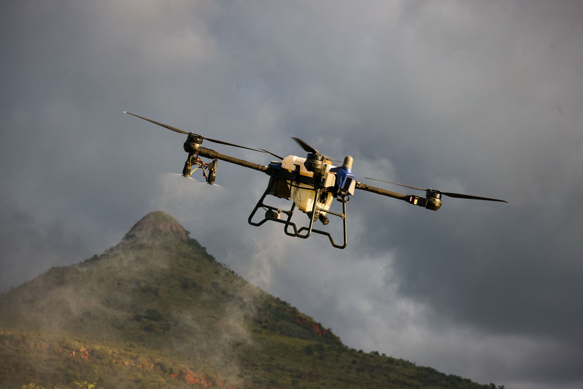
If you do not need the extra lenses, the Mavic 3 Enterprise does most of the Matrice 4E’s job for a lot less money. It flies 45 minutes, uses the same 4/3 CMOS 20MP sensor with a mechanical shutter, and weighs 920 g. RTK is built in, so PPK processing becomes optional rather than mandatory. The folding airframe fits in a backpack, which matters when the site is a 20 minute walk from the truck.
The catch is mass and airflow. A 920 g airframe gets pushed around in 8 m/s wind, and your grid lines drift with it. Photogrammetry software corrects a lot of that, but you will spend more time checking tie points. It also ships with a single camera, so inspection work needs a second aircraft or a rented Matrice. If you are building a fleet, our best DJI drones compared breakdown shows where the Mini and Air lines fit alongside the Enterprise models.
For a firm doing its first paid mapping jobs, that tradeoff is easy to accept. Buy two Mavic 3E bodies before you buy one Matrice 4E, and keep both in the air on a two day project.
Key strengths:
- ✅ 45 minute flight time on a 920 g airframe, which is unusually efficient
- ✅ RTK built in with no extra module to mount or power
- ✅ 20MP 4/3 CMOS sensor with a mechanical shutter, the same core camera as the more expensive models
- ✅ Folds small enough for a backpack, so travel mapping jobs are genuinely practical
- ✅ Low enough cost to buy two and keep a spare in the truck
- ❌ Only one camera, so close inspection work needs another aircraft
- ❌ Noticeably less stable than a heavier airframe in strong wind
- ❌ No IP rating and no LiDAR option at any price
Who it’s for: First-time commercial operators and small firms that need accurate RGB maps without a fleet budget.
3. WingtraOne GEN II , Best for Large-Area Corridor Surveys
The WingtraOne GEN II is a vertical takeoff fixed wing, so it covers ground no quadcopter can touch on one battery. Endurance runs up to 59 minutes, and the 61MP full frame camera produces 1 cm GSD imagery from altitudes a multirotor cannot reach. All-up weight is about 3.7 kg. On a 500 hectare utility corridor, this is the aircraft that turns a two day job into one morning.
There is a learning curve. Fixed wing flight planning rewards smooth air and careful landing zones, and the transition from hover to forward flight takes practice. It does not hover, so you cannot stop and stare at a crack in a retaining wall. Payload options are limited to RGB and multispectral, and repairs go back to the factory instead of a local shop.
It is also the most expensive option in this comparison once you add spare batteries and a second camera. If your typical job is a 40 hectare parcel, a quadcopter is the smarter buy. If your work is pipelines, open pit mines, or coastline mapping, the WingtraOne pays for itself inside a season.
Key strengths:
- ✅ 59 minutes of endurance and hundreds of hectares covered in a single flight
- ✅ 61MP full frame sensor that produces 1 cm GSD imagery from higher altitudes
- ✅ Vertical takeoff and landing, so no runway and no catapult
- ✅ Fixed wing efficiency means fewer batteries and fewer landing cycles per job
- ✅ PPK correction standard, which keeps ground control point counts low
- ❌ The highest price in this comparison once batteries and a spare camera are included
- ❌ Cannot hover, so vertical inspection work is off the table
- ❌ Limited payload options and factory-only repairs
Who it’s for: Teams mapping large open corridors and terrain where endurance matters more than hovering.
4. DJI Matrice 350 RTK with Zenmuse L2 , Best LiDAR Mapping Drone
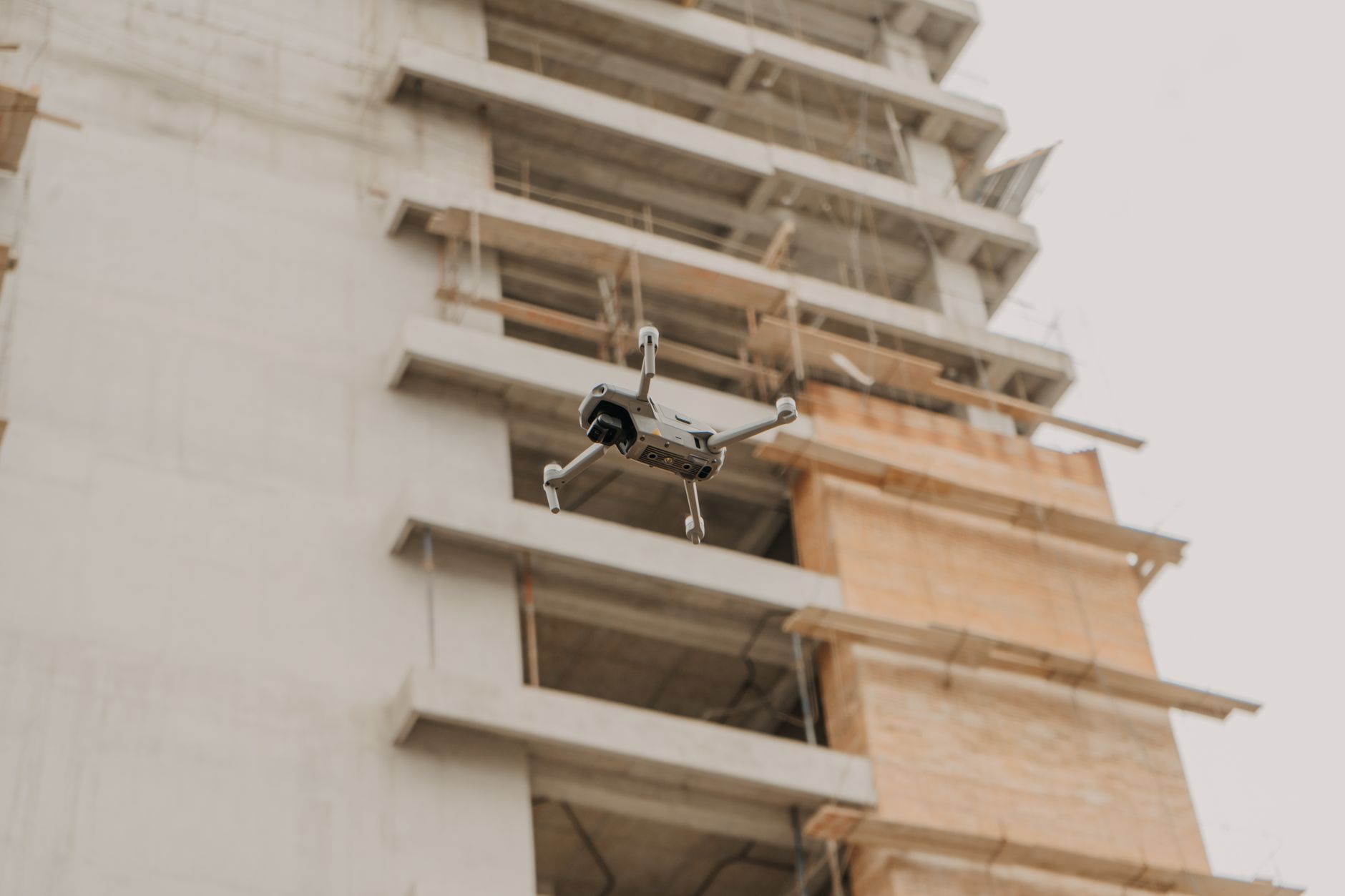
The Matrice 350 RTK is the workhorse for LiDAR mapping. With the Zenmuse L2 gimbal mounted, it fires 240,000 points per second and detects returns up to 450 m at 80 percent reflectivity. That penetrates canopy well enough to model the ground under a forest, which no RGB camera can do at any altitude. Flight time is 55 minutes, maximum takeoff weight is 9.2 kg, and the airframe carries an IP55 rating. Dual hot-swappable batteries mean you can keep flying while the first pair cools.
Everything about it is heavier. Two people is the realistic crew size for a full LiDAR mission, and the data volume needs a workstation rather than a laptop for processing. Expect the flight time to drop once the L2 and its cooling load are bolted on. Thermal inspection work fits the same airframe with the H20T or H20N gimbals, so one aircraft can carry two service lines for your business.
This is not the drone to buy first. It is the drone to buy once LiDAR work is a line item on your invoices and you have someone who enjoys point cloud processing.
Key strengths:
- ✅ 240,000 points per second with returns detected up to 450 m at 80 percent reflectivity
- ✅ 55 minute flight time and dual hot-swappable batteries for long field days
- ✅ 55 minute spec plus IP55 weather resistance for real working conditions
- ✅ Bare-earth models under canopy that RGB photogrammetry simply cannot produce
- ✅ Same airframe accepts thermal and zoom gimbals for inspection revenue
- ❌ 9.2 kg takeoff weight means a two person crew and a proper case
- ❌ Point cloud processing needs a workstation and real software skill
- ❌ Highest total cost here by a wide margin once LiDAR and spares are counted
Who it’s for: Survey, forestry, and mining teams that need bare-earth models under vegetation.
5. Autel EVO Max 4T , Best Non-DJI Mapping Option
Autel’s EVO Max 4T is the strongest non-DJI option for mapping in 2026. Flight time is 42 minutes, weight is 1,600 g, and the wide camera is a 4/3 CMOS 50MP sensor paired with a 48MP zoom. Obstacle sensing covers 720 degrees, the body is rated IP43, and image transmission is rated up to 20 km in FCC mode. RTK is available, and the aircraft carries a night mode plus thermal, which makes it a genuinely flexible single-airframe purchase.
The weakness is the software side. Autel’s mapping app is less mature than DJI Terra, and third-party photogrammetry tools support Autel EXIF data less consistently. Firmware updates arrive more slowly, and the pool of pilots who can help you troubleshoot is smaller. Those are real costs when a client is waiting on a deliverable.
If you want to avoid DJI entirely, this is the aircraft we would name first. Our roundup of the best DJI alternatives in 2026 goes deeper on where Autel wins and where it still trails.
Key strengths:
- ✅ 42 minute flight time and 1,600 g weight, light enough for one pilot
- ✅ 4/3 CMOS 50MP wide camera with a 48MP zoom on the same gimbal
- ✅ Rated up to 20 km of transmission range in FCC mode
- ✅ 720 degree obstacle sensing plus thermal and night modes built in
- ✅ A real alternative if procurement rules keep DJI out of your fleet
- ❌ No mechanical shutter, so rolling shutter distortion shows up on fast mapping passes
- ❌ Mapping software and third-party EXIF support trail DJI Terra
- ❌ Smaller user community means slower troubleshooting on a deadline
Who it’s for: Operators who want RTK mapping accuracy without buying into DJI hardware and software.
Frequently Asked Questions
Do I need a license to fly a mapping drone commercially?
In the United States, yes. Commercial mapping falls under Part 107, which requires passing the knowledge test and holding a Remote ID compliant aircraft. In Canada, most commercial mapping needs at least a basic operations certificate, and flights near airports or over people push you into advanced certification.
Can a drone replace a total station or GPS rover for surveying?
For large-area topographic mapping and volumetrics, yes. For boundary surveys and legally defensible property lines, no. Drone photogrammetry gives you a dense surface model, but boundary work still needs ground equipment and a licensed surveyor.
How much flight time do I really get from a mapping drone?
Plan on 70 to 80 percent of the manufacturer claim. A 49 minute spec becomes 35 to 40 minutes of actual mapping once you climb to altitude, hold a grid pattern, and fight wind. Cold weather cuts that further.
Do I still need ground control points if my drone has RTK?
Fewer, not zero. RTK fixes the camera position, but you should still place a handful of check points to verify the model. If your RTK correction source drifts or the base station is poorly placed, check points are how you catch it before delivery.
How many hectares can one mapping drone cover in a day?
A quadcopter like the Matrice 4E realistically covers 300 to 500 hectares across a full day with battery swaps and setup time. A fixed wing like the WingtraOne GEN II can pass that in a single flight on large open corridors.
What is the best mapping drone for a small firm just starting out?
The DJI Mavic 3 Enterprise. It flies 45 minutes, carries a 20MP 4/3 CMOS sensor with a mechanical shutter, weighs 920 g, and has RTK built in. It is the least expensive way to produce centimeter-level RGB maps without a crew.
What Should You Remember?
- RTK is table stakes in 2026. Every drone on this list supports RTK or PPK, and none of them hit centimeter accuracy without that correction.
- Expect 70 to 80 percent of the claimed flight time. A 49 minute spec means 35 to 40 minutes of real mapping.
- A mechanical shutter beats a bigger sensor. Rolling shutter distortion ruins photogrammetry faster than a 20MP limit hurts detail.
- LiDAR is a separate budget. The Matrice 350 RTK with the Zenmuse L2 costs more than the rest of this list combined and needs a workstation for processing.
- Registration and Remote ID apply to all five. Every aircraft here sits far above the FAA’s 250 g threshold.
- Spare batteries finish surveys, not new cameras. Three packs and a field charger save more field time than any payload upgrade.
- Match the aircraft to the site. Fixed wing for corridors, quadcopter for parcels, LiDAR for canopy.
This article is for general information only. Drone regulations vary by region and change frequently , always verify current local laws and airspace rules before flying.